WHITEWATER FLOOD RISK CHART
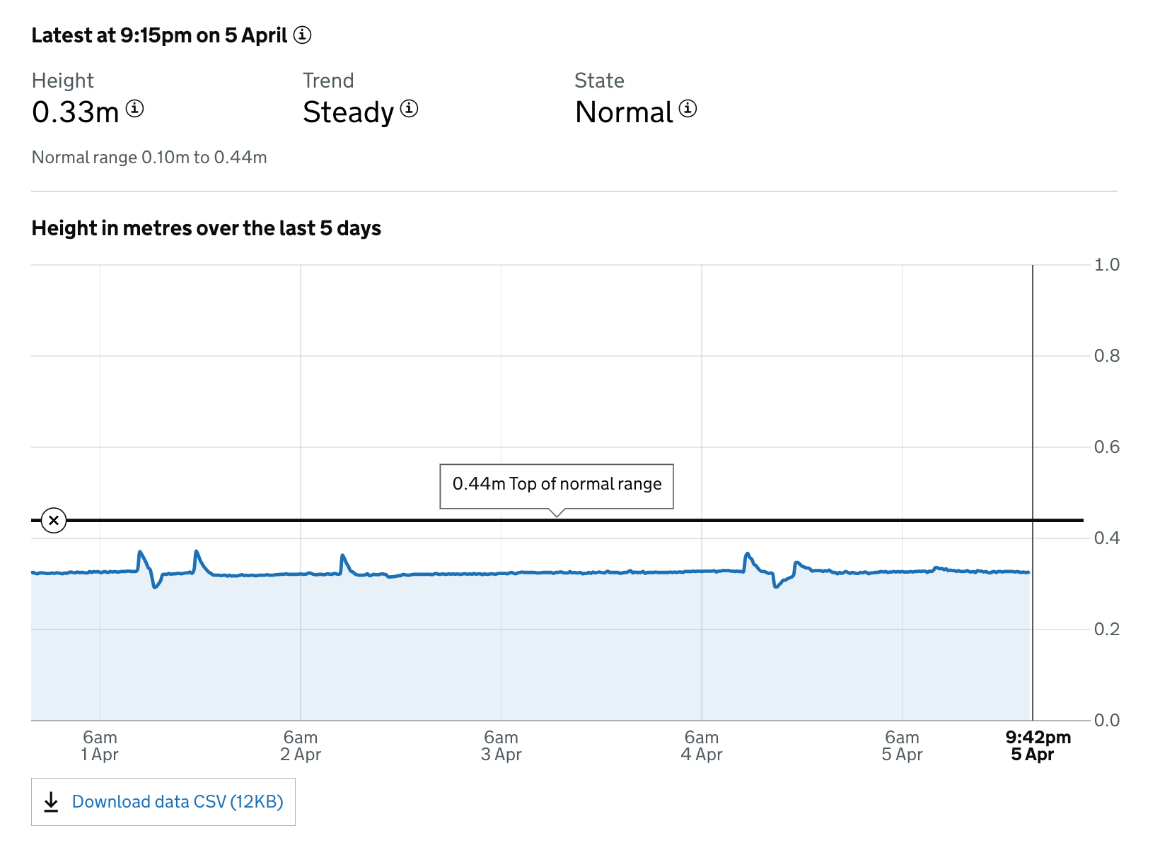
The Environment Agency has provided a flood risk chart for the Whitewater, updated in real time, showing current water levels. An example of the typical view of the chart is shown below.
The Environment Agency has provided a flood risk chart for the Whitewater, updated in real time, showing current water levels. An example of the typical view of the chart is shown below.